Trips
Favorite photos
Peak lists
References
Search
Colockum Wildlife Area
Date:
2019/05/18 to 2019/05/19
Car-to-car:
2 days
Round-trip distance:
22 miles
Elevation gain:
3,500 feet
Trip type:
hike
USGS quad:
West Bar
Loading map...
Day 1
Tarpiscan Road
Fording Tarpiscan Creek
There was a lot of poison ivy around the creeks
Columbia River from the north ridge of Cape Horn
The cliffy NE side of Cape Horn
The top of Cape Horn was acres and acres of lupine
Brewton Road
Day 2
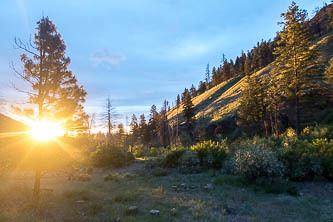
Unreal sunrise colors at our camp where Tarpiscan Road crosses South Fork Tarpiscan Creek
Yellow Salsify
Cape Horn
Columbia River and West Bar
Copyright © 2026 Gabriel Deal.
‹
›
×