Trips
Favorite photos
Peak lists
References
Search
Robinson Mountain
Date:
2015/08/01 to 2015/08/02
Car-to-car:
2 days
Trip type:
scramble
USGS quad:
Robinson Mountain
Loading map...
Day 1
Walking up the Robinson Creek Trail.
The intersection with the Beauty Creek Trail was obscured by brush. We walked right past it even though we were looking for it.
The Beauty Creek Trail with Last Chance Point in the background.
Hiking up the meadow after leaving the trail.
The 6,700' pond.
Looking towards Setting Sun Mountain from the 6,700' pond,
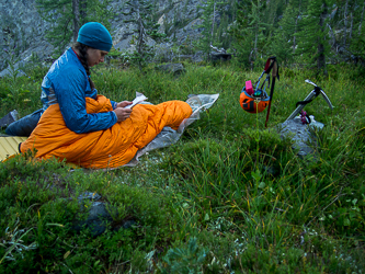
I was surprised not to find any established campsites near the pond.
Day 2
Point 7,200'+ and Silver Star Mountain.
On the ridge to the north of the 4,700' pond.
Robinson Mountain.
Instead of taking the exposed 3rd class section of ridge, we traversed below on the south side of the ridge. I don't know if it was any better.
On the summit of Robinson Mountain.
U.S. and Canada boundary survey marker on the summit of Robinson.
Back on the Beauty Creek Trail.
Copyright © 2026 Gabriel Deal.
‹
›
×