Glacier Peak circumnavigation

This was a great trip. I would definitely do it again.

Route summary: White River Trailhead, up the Indian Creek Trail, up the PCT to White Pass (instead of going over Red Pass, we took a half-day, cross-country side trip to the area below the White Chuck Glacier), PCT to the Suiattle River, trail #789 to Buck Creek Pass, up the Liberty Cap Trail, over High Pass (some off-trail), down the Napeequa Valley (some off-trail), over Boulder Pass, down the White River Trail and back to the White River Trailhead.

  • Date:
    2015/07/21 to 2015/07/26
    Car-to-car:
    6 days
    Round-trip distance:
    94 miles
    Trip type:
    backpack
  • Day 1

  • The White River Trailhead.
    The White River Trailhead.
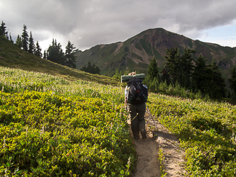
  • Hiking up the Indian Creek Trail.
    Hiking up the Indian Creek Trail.
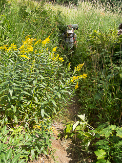
  • The sometimes brushy Indian Creek Trail.
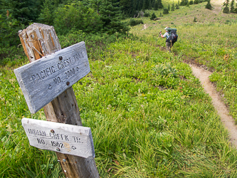
    The sometimes brushy Indian Creek Trail.
  • The PCT!
    The PCT!
  • The Dakobed Range from the PCT.
    The Dakobed Range from the PCT.
  • White Mountain from the PCT.
    White Mountain from the PCT.
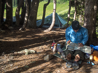
  • Our camp at White Pass.
    Our camp at White Pass.
  • White Pass and White Mountain with its head in the clouds.
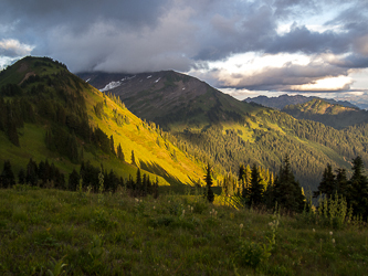
    White Pass and White Mountain with its head in the clouds.
  • Looking SE from White Pass.
    Looking SE from White Pass.
  • Johnson Mountain and Pilot Ridge.
    Johnson Mountain and Pilot Ridge.
  • The North Fork Sauk River Valley.
    The North Fork Sauk River Valley.
  • Day 2

  • Sloan Peak from the White Pass campground.
    Sloan Peak from the White Pass campground.
  • Foam Creek Trail.
    Foam Creek Trail.
  • The headwaters of Foam Creek.
    The headwaters of Foam Creek.
  • The foot of the White Chuck Glacier.
    The foot of the White Chuck Glacier.
  • We crossed this creek at least 10 times.
    We crossed this creek at least 10 times.
  • Lake 6,120' and point 6,810'.
    Lake 6,120' and point 6,810'.
  • Lake 6,120' with a sub-summit of Baekos Peak in the background.
    Lake 6,120' with a sub-summit of Baekos Peak in the background.
  • Kololo Peaks (right) and the White Chuck Glacier.
    Kololo Peaks (right) and the White Chuck Glacier.
  • The NE side of White Mountain.
    The NE side of White Mountain.
  • Back on the PCT.
    Back on the PCT.
  • Kennedy Creek
    Kennedy Creek
  • Mount Pugh and White Chuck Mountain over the White Chuck River (I think).
    Mount Pugh and White Chuck Mountain over the White Chuck River (I think).
  • Day 3

  • Breaking our camp near Fire Creek.
    Breaking our camp near Fire Creek.
  • Fire Creek Pass
    Fire Creek Pass
  • Mica Lake
    Mica Lake
  • Our only Glacier Peak sighting for the whole trip.
    Our only Glacier Peak sighting for the whole trip.
  • Hellebore heaven!
    Hellebore heaven!
  • Camp on the PCT near the Suiattle River.
    Camp on the PCT near the Suiattle River.
  • Day 4

  • The Suiattle River.
    The Suiattle River.
  • Bubble's ad hoc rain skirt made out of duct tape and her Tyvek ground cloth.
    Bubble's ad hoc rain skirt made out of duct tape and her Tyvek ground cloth.
  • Camp at Buck Creek Pass.  We camped early this day because we did not want to go over High Pass with bad weather and limited time.
    Camp at Buck Creek Pass. We camped early this day because we did not want to go over High Pass with bad weather and limited time.
  • Day 5

  • Past the end of maintained trail, SE of Liberty Cap.
    Past the end of maintained trail, SE of Liberty Cap.
  • High Pass
    High Pass
  • The headwaters of the Napeequa River.
    The headwaters of the Napeequa River.
  • The Napeequa Valley!
    The Napeequa Valley!
  • The key trail from the upper Napeequa Valley to the lower valley.
    The key trail from the upper Napeequa Valley to the lower valley.
  • Louis Creek
    Louis Creek
  • Napeequa River
    Napeequa River
  • I came around the corner and almost ran into this guy.
    I came around the corner and almost ran into this guy.
  • Little Giant Pass and the Napeequa River.
    Little Giant Pass and the Napeequa River.
  • Our last look at the Napeequa before going over Boulder Pass.
    Our last look at the Napeequa before going over Boulder Pass.
  • White Mountains and Mount David in the distance?
    White Mountains and Mount David in the distance?
  • Sub-summits of Clark Mountain over the Boulder Creek Trail.
    Sub-summits of Clark Mountain over the Boulder Creek Trail.
  • The Boulder Creek Valley
    The Boulder Creek Valley
  • Camp by the White River.
    Camp by the White River.
  • Day 6

  • The White River Trail
    The White River Trail
  • Back at our trailhead by the White River.
    Back at our trailhead by the White River.

  • Copyright © 2024 Gabriel Deal.