Trips
Favorite photos
Peak lists
References
Search
Mile High Mtn & Toto
Date:
2015/03/13
Car-to-car:
11 hours 11 minutes
Trip type:
scramble
USGS quad:
Snoqualmie Lake
References:
Monty's report for our trip
Loading map...
Crossing the Dorothy Lake outlet.
Cascade Mountain
The summit of Toto Peak.
In Mile High's NE basin.
Cascade Mountain
Cascade Mountain
Approaching the treed line we ascended to cross from the basin up to Mile High's north ridge.
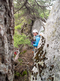
One of many obstacles that Mile High's north ridge presented.
The summit of Mile High Mountain.
On the summit of Mile High Mountain with Treen Peak in the background.
Snoqualmie Lake with Mount Thomson, Sorcery Mountain, and Snoqualmie Mountain in the background.
On the "white brick road" part of Toto's west ridge.
Snoqualmie Range peaks over Lake Dorothy.
Descending Toto's NE ridge.
Crossing Lake Dorothy's outlet.
Copyright © 2026 Gabriel Deal.
‹
›
×