Mount Sawyer
Lindsay and I parked on Road 310 at the west end of Tonga Ridge trail
and hiked up the trail. When we were near the pass between Mount Fin
(point 5280+) and Mount Sawyer, we left the trail and ascended via the
west ridge of Mount Sawyer. This was a little brushy with nice views
and optional rock scrambling.
I was surprised to hear voices as we neared the summit of Mount
Sawyer. Who knew there was a trail to the summit? Apparently many
people, judging by the number of parties on the summit. These people
gave me funny looks when I arrived at the top, one asked me why I took
the bushwack route. It's not on either of my maps, but a well-traveled
trail ascends the SW side of the mountain.
We spent more time sunning on the summit than we spent
hiking to the top. Good trip.
Elevation gain:
1,195 feet
In:
Highway 2 Corridor, Alpine Lakes Wilderness
Car-to-car:
5 hours 10 minutes
-
1 hour 39 minutes
ascending
from
Tonga Ridge trail head (west)
to
summit of Sawyer Mountain
-
1 hour 39 minutes
descending
from
summit of Sawyer Mountain
to
Tonga Ridge trail head (west)
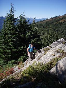
Scrambling up the west ridge of Mount Sawyer
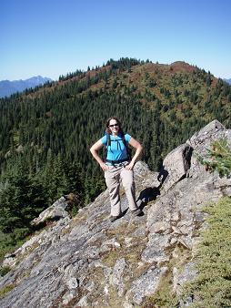
Lindsay on west ridge of Mount Sawyer, Mount Fin in the background
Copyright © 2026 Gabriel Deal.