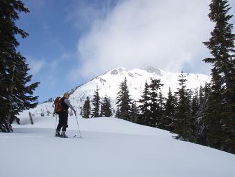
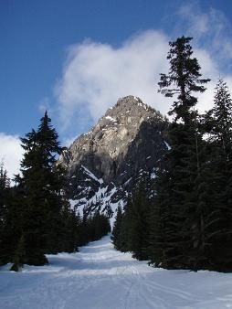
Cave Ridge from Commonwealth Basin
Bruno and I parked at the Summit at Snoqualmie's west parking lot,
walked through the I-90 underpass, and hiked up the snowbank on the
other side. There we put our skis in the rain. It reminded me of an
advertisement on a Seattle Metro bus, "Customer profile #3: Skis in
the rain guy", something about how PEMCO Insurance serves the needs of
unique and quirky Seattle customers.
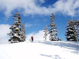
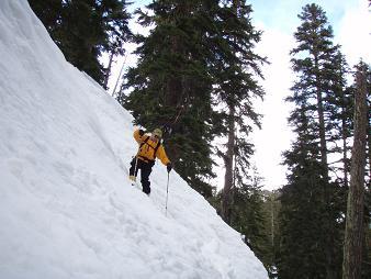
We skied up Commonwealth Basin, crossed Commonwealth Creek, then
headed up the moderate ridgelet that starts at 3,800 and leads to a
basin between Cave Ridge and Guye Peak. From the basin we went north
too early and ascended through young trees. But eventually this led
us to lovely views at the top of Cave Ridge. And a light, breakable
crust.
On the way down we booted through the young trees back down to the
basin. Then we made the mistake of following ski tracks and ended up
SW of the ridgelet that leads down to Commonwealth Basin, on the wrong
side of the gully. It suckered us with pleasant slopes, then when the
gully gets ugly the slope on our side got too steep. More booting
down to the basin.
We stayed on the west side of Commonwealth Creek on the way down.
This was very nice skiing and led us to the Sahalie Ski Club
(
http://www.sahalie.org/). We skied down the club's slopes and at the
bottom a very friendly, polite employee asked me to avoid the ski area
in the future as it is for members only. He really was very nice, and
the club looks like an excellent place for families to go, lots of
kids skiing and parents hanging out.
Elevation gain:
2,290 feet
Trip type:
backcountry ski
USGS quad:
Snoqualmie Pass
In:
South Fork Snoqualmie Drainage
Car-to-car:
6 hours 12 minutes
-
22 minutes
driving there
from
Lower Queen Anne
to
Eastgate shopping area
-
39 minutes
driving there
from
Eastgate shopping area
to
Summit at Snoqualmie West parking lot
-
3 hours 38 minutes
ascending
from
Summit at Snoqualmie West parking lot
to
top of Cave Ridge
-
2 hours 5 minutes
descending
from
top of Cave Ridge
to
Summit at Snoqualmie West parking lot
Snoqualmie Mountain from Cave Ridge
Top of Cave Ridge
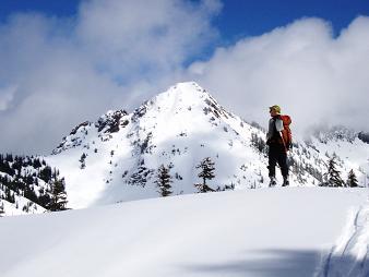
Red Mountain from Cave Ridge
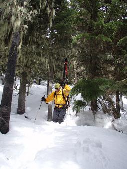
Note to self: avoid these trees on Cave Ridge
Note to self: stay to the left of the gully when descending!
Guye Peak from the road above the Sahalie Ski Club
Copyright © 2026 Gabriel Deal.