Lost Lake, Loser Ridge loop
Carla and I parked at the Price Creek rest area and followed the trail
(shown on Greentrails) that heads NW to the Keechelus Lake dam. We
crossed the dam then headed NW up the John Wayne Pioneer Trail (no
snowmobiles allowed on this trail). After crossing Roaring Creek, we
left the John Wayne trail and traveled a short distance west
cross-country until we hit the road (road 5480?) that leads to Lost
Lake. We followed this road to Lost Lake.
At Lost Lake we followed the road that runs above the south side of
Lost Lake. Right before the first creek crossing shown on USGS, we
headed SE to the saddle west of little point 4,200'+. From the
saddle, we went SW up the sub-ridge that leads to the top of Loser Ridge.
We descended via logging roads to point 4,480'+, this is the start of
the long, bald part of the ridge that can be seen over Keechelus Lake
from I-90. From point 4,480'+ we descended east about 400 feet to the
logging road, then descended logging roads to the Meadow Creek road.
Although the snow was an inch of powder over icy, frozen spring snow,
we encountered no real difficulties other than skinning up a couple
steep, slippery spots. I had a blast skiing down the cruddy snow,
especially the frozen snowmobile-churned roads, it was a real learning
experience.
Elevation gain:
2,270 feet
Trip type:
backcountry ski
Car-to-car:
7 hours 50 minutes
-
58 minutes
driving there
from
Capitol Hill
to
Price Creek rest area
-
2 hours 43 minutes
ascending
from
Price Creek rest area
to
Lost Lake
-
1 hour 55 minutes
ascending
from
Lost Lake
to
summit of Loser Ridge
-
51 minutes
descending
from
summit of Loser Ridge
to
Loser Ridge point 4480'+
-
2 hours 3 minutes
descending
from
Loser Ridge point 4480'+
to
Price Creek rest area
-
1 hour 4 minutes
driving back
from
Price Creek rest area
to
Capitol Hill
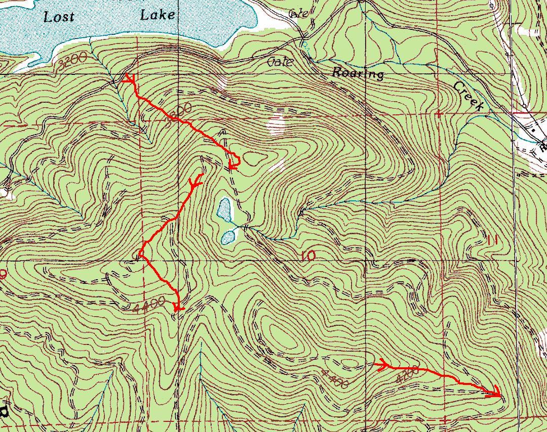
Lost Lake, Loser Ridge loop route
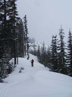
Ascending the SW sub-ridge of Loser Ridge
Copyright © 2026 Gabriel Deal.