Teanaway Ridge loop via Highway 97
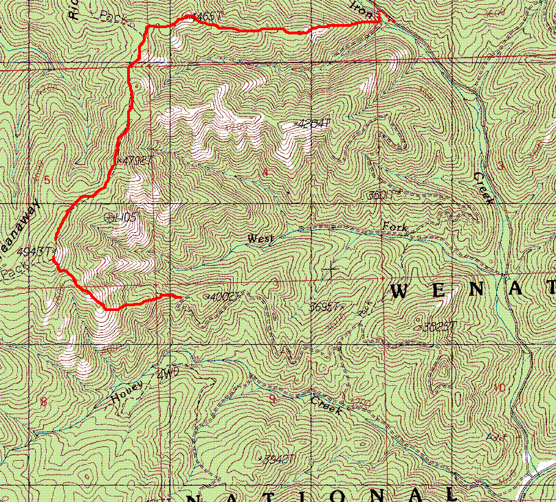
We parked at the intersection of Highway 97 and Road 9714 (at Iron
Creek). We headed SW up a third road, after about a mile we headed
north up a spur road (actually I think we took an earlier road not on
the map and ended up doing a bit of cross-country to get back on
route). We followed roads until they ended just west of point 4,002'.
From there we followed the ridge to the top at 4,943'.
From the summit we took the ridge NE, crossing point 4,792',
accidently detouring off the ridge shortly after, we got back on route
and finally headed back toward the car via the ridge with point 4,465'
on it.
See the route map below for details. No difficulties on this route.
We did have to pay close attention to navigation since all those
ridges look the same!
Elevation gain:
2,075 feet
In:
Teanaway, US 97 Corridor
Car-to-car:
6 hours 7 minutes
-
35 minutes
driving there
from
Wallingford
to
Preston park and ride
-
1 hour 29 minutes
driving there
from
Preston park and ride
to
intersection of Highway 97 and Road 9714
-
2 hours 30 minutes
ascending
from
intersection of Highway 97 and Road 9714
to
top of Teanaway Ridge
-
3 hours 10 minutes
descending
from
top of Teanaway Ridge
to
intersection of Highway 97 and Road 9714

Teanaway Ridge loop route map
Copyright © 2024 Gabriel Deal.