Mount Roosevelt (attempted)
Carla and I parked at the Snow Lake trailhead and hiked up the trail,
which turned out to be the wrong way to go in the winter. Once we
reached a clearing where we could see where the trail threads up
through the cliff bands, we turned off the trail and headed north up a
more moderate part of the east-west ridge that is south of Snow Lake.
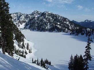
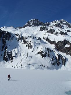
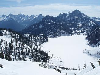
Snow Lake was still completely frozen over. Carla walked across the
lake while I, being scared of walking across lakes, skirted the side.
Eventually we came to the west side of the lake, zigzagged up the snow
bowls between the lake and Roosevelt, and made our way to the gully
between the summit of Roosevelt and a subsidiary peak to the south
of Roosevelt.
Here we tried to ascend the gully between Roosevelt and the
south peak, then at the top of the gully we traversed right (north)
until we came to a steep, exposed section of snow that we weren't
willing to follow.
Second try was to ascend a more moderate gully a little way to the
south. This got us up on the ridge between Kaleetan Peak and Mount
Roosevelt, here we had excellent views of the north ridge of Kaleetan
Peak. We followed the ridge north until we met the rocky subsidiary
peak south of Roosevelt. Convinced we were on route I tried
scrambling the crumbly, exposed rock for fifty feet or so before
coming to my senses and descending while the descending was marginal
and not horrible.
Defeated, we descended to the lake, braving wet snow slides on the
way. By this time I was used to risks so I walked the full 1+ miles
across frozen Snow Lake.
On the way back we descended via Source Lake instead of the main
trail, which is a much better way to access Snow Lake in the winter.
Elevation gain:
2,485 feet
USGS quad:
Snoqualmie Pass
In:
Middle Fork Snoqualmie Drainage, Alpine Lakes Wilderness
Car-to-car:
10 hours 52 minutes
-
52 minutes
driving there
from
Capitol Hill
to
Snow Lake trailhead
-
2 hours 22 minutes
ascending
from
Snow Lake trailhead
to
Snow Lake outlet
-
2 hours 57 minutes
ascending
from
Snow Lake outlet
to
closest we got to the summit (up snow finger)
-
2 hours 5 minutes
ascending
from
closest we got to the summit (up snow finger)
to
second closest we got to summit (partially up N peak of Roosevelt)
-
1 hour 39 minutes
descending
from
second closest we got to summit (partially up N peak of Roosevelt)
to
Snow Lake
-
1 hour 49 minutes
descending
from
Snow Lake
to
Snow Lake trailhead
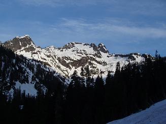
Chair Peak from Snow Lake trail
Bryant Peak from Snow Lake Trail
Bryant Peak and Chair Peak from Snow Lake trail
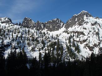
The Tooth, Hemlock Peak, and Bryant Peak from Snow Lake Trail
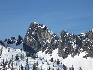
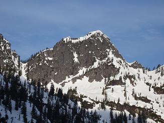
The Tooth from Snow Lake trail
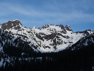
Denny Mountain from Snow Lake trail
Wright Mountain over Snow Lake
Carla on Snow Lake, Mount Roosevelt in background
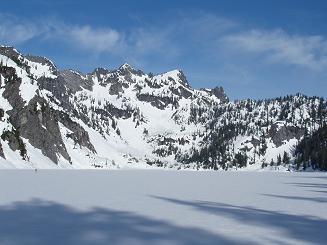
Mount Roosevelt over Snow Lake
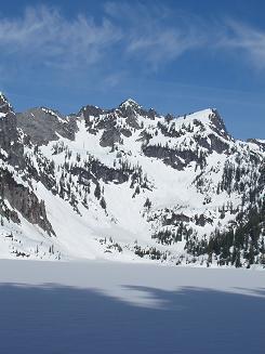
Mount Roosevelt over Snow Lake
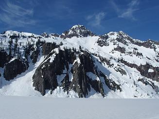
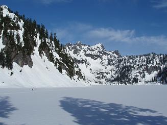
Chair Peak over Snow Lake
Chair Peak over Snow Lake
Middle Fork peaks, Avalanche Mountain, and Snoqualmie Mountain over Snow Lake
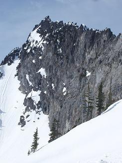
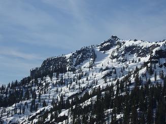
East side of the north ridge of Kaleetan Peak
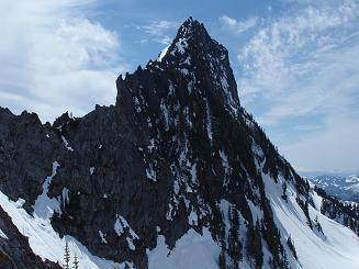
West side of the north ridge of Kaleetan Peak
Copyright © 2026 Gabriel Deal.