Mount Shuksan via the Sulphide Glacier
Our group of 12 Mountaineers met at the end of FS road 1152-014. We
hiked the boot path (which was largely made of squishy mud that was
lovely on my knees on the way down) to the south end of the Sulphide
Glacier. USGS shows the bootpath ending where it meets the ridge at
4,600' but the path continues up the ridge, through the 5,400'+ pass,
to the glacier.
We unroped at the base of the summit pyramid and ascended the gully
on the SW side of the summit pyramid. It had wet snow all the way up,
on the way down a member of the party above me fell and triggered a
wet snow slide that I had to hustle to dodge. Someone also kicked a
rock down near me. I felt like a target.
All in all an outstanding trip. From the point where the bootpath met
the top of the ridge we had excellent views. The steepness of the
summit pyramid added a little spice.
Round-trip distance:
14 miles
Elevation gain:
6,535 feet
Trip type:
basic glacier climb
Car-to-car:
14 hours 7 minutes
-
4 hours 16 minutes
ascending
from
trailhead
to
High Camp
-
4 hours 30 minutes
ascending
from
High Camp
to
Mount Shuksan summit
-
5 hours 4 minutes
descending
from
Mount Shuksan summit
to
trailhead
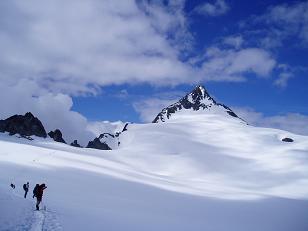
Summit pyramid of Mount Shuksan from the Sulphide Glacier
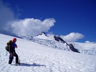
Summit pyramid of Mount Shuksan from High Camp
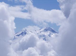
Mount Baker from the base of the summit pyramid on Mount Shuksan
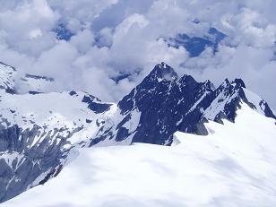
Jagged Ridge from the summit of Mount Shuksan
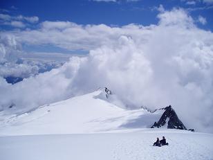
Ridge south of the summit of Mount Shuksan
Copyright © 2024 Gabriel Deal.