Kings Mountain and Elk Mountain loop
We parked at the Kings Mountain trailhead and headed up the trail,
very soon we took a right towards Elk Mountain. The trail traverses
above the highway slowly gaining elevation until a three-way
intersection on a ridge, we went left up the ridge following the trail
as it climbs steeply to the summit of Elk Mountain. At some points
this trail almost becomes a scramble instead of a hike.
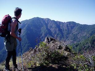
From the summit of Elk Mountain we had great views of Kings Mountain
and the coast range to the south. Mount Hood was also visible.
From the summit we headed north on the trail, the trail was again very
rough for a short distance as it descended 200 feet to the ridge that
leads to Kings Mountain. But soon the trail started following an old
logging road, and most of the way to Kings Mountain it was an easy
hike. The trail became a bit exposed where it crossed over onto the
NW side of the N ridge of Kings Mountain, and after the ridge crossing
the trail was often covered with an icy covering of snow.
From the summit we descended south on the trail, it was steep but not
as steep as the trail leading up to Elk Mountain.
Round-trip distance:
11 miles
Elevation gain:
2,615 feet
USGS quads:
Woods Point, Jordan Creek
Car-to-car:
5 hours 23 minutes
-
56 minutes
ascending
from
Kings Mountain trailhead
to
trail intersection on ridge to Elk Mountain
-
1 hour 3 minutes
ascending
from
trail intersection on ridge to Elk Mountain
to
Elk Mountain summit
-
1 hour 45 minutes
ascending
from
Elk Mountain summit
to
Kings Mountain summit
-
50 minutes
descending
from
Kings Mountain summit
to
Kings Mountain trailhead

Kings Mountain from summit of Elk Mountain

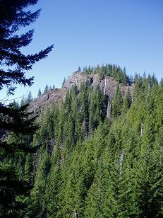
SE side of Elk Mountain from the trail
Copyright © 2024 Gabriel Deal.