NW end of Prospectors Ridge
I parked on Road 57 and walked up road 5740. The logging road was
clear enough to mountain bike until the first sharp right turn,
afterwards the road was almost too choked with brush to even hike.
Soon I noticed some old-growth forest on the ridge to the left, I cut
over and found the woods much more pleasant. Around 3,100' I met the
road again and followed it to its end in a small gully full of
logging debris, I then traversed NNW to the old growth forest on
another ridge. The ridge was very steep and I found my ice axe very
useful for self-belay in the dirt at times, but there were no
technical difficulties. This led me to the far NW finger of
Prospectors Ridge at 3,800'. I followed the ridge dodging a couple
gendarmes until 4,000', at this point I faced 200 vertical feet of
dense, young, snowy hemlock and decided I had found a good turn around
point.
As I had lunch before heading back the clouds allowed me a couple
glimpses of a short finger of the ridge that runs NE at 4,200', it
could be an awesome vantage point but I couldn't tell if it would be a
technical climb to reach it.
Round-trip distance:
6 miles
Elevation gain:
1,990 feet
In:
North Fork Snoqualmie Drainage
Car-to-car:
5 hours 28 minutes
-
14 minutes
driving there
from
Lower Queen Anne
to
intersection of I-90 and I-405
-
1 hour 22 minutes
driving there
from
intersection of I-90 and I-405
to
trailhead
-
2 hours 36 minutes
ascending
from
trailhead
to
where I turned around
-
2 hours 20 minutes
descending
from
where I turned around
to
trailhead
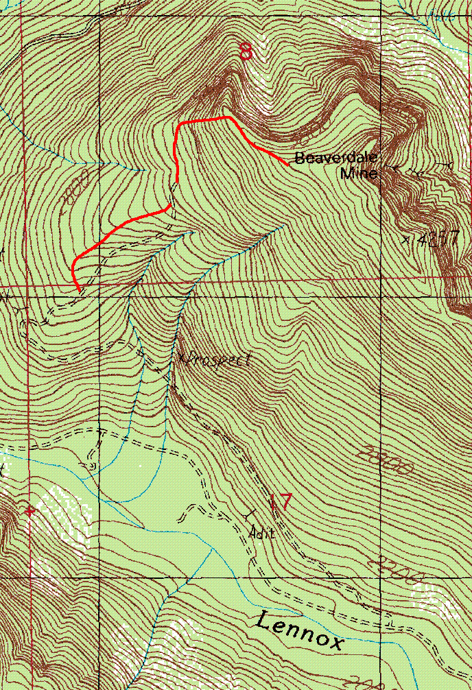
Prospectors Ridge route map
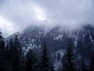
The ridge NE of Sunday Lake taken from 3,000' on Prospect
Copyright © 2026 Gabriel Deal.