Hancock's Comb via logging roads
I parked at North Fork gate 11.
I rode my mountain bike east on road
32000. Road 32000 (labeled "Spur 10" on Greentrails) had a sign
stating that no motorized access is allowed without a permit, call
Hancock Forest Management at (360) 825-1637 for more information.
The map says it all, so I won't give details of which roads I took. The
roads are well marked up to the last turn-off to Lake
Hancock (which I didn't take), and they are gradual enough that I
didn't have to push my bike up the road very often. The roads are
also in excellent shape, on my ride down I averaged 10+ miles per
hours, I would have gone faster if I didn't have to worry about
logging trucks on their way up. The Hancock's Comb area is actively
being logged, I encountered a bulldozer and lot of trucks on the
road and there were about 10 loggers working just SW of Hancock's Comb.
I parked my bike next to a berm south of Hancock's Comb and continued
east on the road for a short distance then ascended the SE ridge of
Hancock's Comb. The ascent was a continual bushwack to the top.
Round-trip distance:
16 miles (1 mile on foot, 15 miles on bike)
Elevation gain:
3,650 feet
Trip type:
scramble, mountain bike
In:
North Fork Snoqualmie Drainage
Car-to-car:
5 hours 30 minutes
-
34 minutes
driving there
from
Lower Queen Anne
to
exit 31
-
3 minutes
driving there
from
exit 31
to
North Bend
-
9 minutes
driving there
from
North Bend
to
where North Fork Road turns into gravel
-
9 minutes
driving there
from
where North Fork Road turns into gravel
to
North Fork gate 11
-
2 hours 45 minutes
ascending via bike
from
North Fork gate 11
to
berm below Hancock's Comb
-
38 minutes
ascending
from
berm below Hancock's Comb
to
Hancock's Comb
-
35 minutes
descending
from
Hancock's Comb
to
berm below Hancock's Comb
-
46 minutes
descending via bike
from
berm below Hancock's Comb
to
North Fork gate 11
-
20 minutes
driving back
from
North Fork gate 11
to
North Bend
-
20 minutes
driving back
from
North Bend
to
intersection of I-90 and I-405
-
21 minutes
driving back
from
intersection of I-90 and I-405
to
Lower Queen Anne
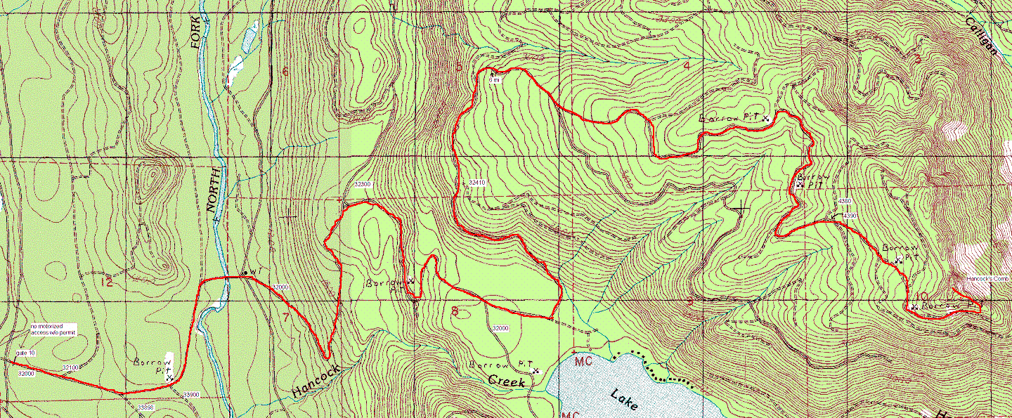
Hancock's Comb via logging roads map
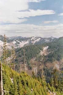
Paperboy Peak from Hancock's Comb
Bessemer Mountain, South Bessemer Mountain, and Moolock
-and-Paperboy-Peak-from-Hancock's-C.jpeg)
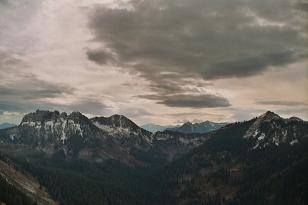
Boomerang Peak (left) and Paperboy Peak from Hancock's C
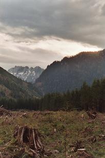
Bessemer Mountain over clearcut near Lake Hancock
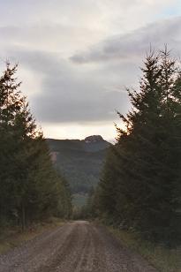
Hancock's Comb from just past North Fork gate 11
Copyright © 2026 Gabriel Deal.