Middle Sister and South Sister
We left the truck at the Obsidian trailhead (trail #3528) and hiked to
the southern border of the Obsidian limited entry area on the PCT. We
found a very nice campsite to the east of the PCT a couple hundred
feet south of the limited entry area. 2 hours 15 minutes from
trailhead.
The next morning we took a boot path east, we scrambled the north side
of the Folding Rock, and stayed on rock until almost reaching the
saddle between North and Middle Sister. From there we headed south
and took an easy boot path to the top of Middle Sister. 3 hours 20
minutes from camp.
We took the south ridge off of Middle Sister. The upper part had a
lot of scree that was fun to slide down on. Later it turned into loose
rock and then a couple snow fields, earlier in the year this might be
nice to take skis on. The Chambers Lakes valley between Middle and
South Sister is beautiful, it has some very vibrant orange rock that
from afar looks like it it vegetation, this would be a good place to
camp. Lots of water here.
We took the north ridge up South Sister. At first it is just a steep
slog. Below the buttress at 9,400 feet it starts turning onto a
scramble. The route goes around the right side of the buttress, at
this point I think the route ceases to be a scramble and becomes a
climb. There is exposure, the rock is fairly steep, and the rock
hardly deserves the name "rock". It's closer to really tough red cake
frosting, half of the handholds can be kicked off after using them.
We should have turned around at this point, but we didn't. The crummy
red rock lasts until about 20 feet below the top of the buttress, at
this point we had to either climb some almost vertical rock with good
handholds or put on crampons and traverse to the right. We climbed.
The remaining few hundred vertical feet are a cakewalk. 5 hours 50
minutes from the summit of Middle Sister to the summit of South
Sister.
The views on top of South Sister were great. Rainier and Helens were
barely visible, Adams, Hood, Jefferson, and all the other local peaks
were out. It was two hours until sunset so I didn't even take the
time to look south. In warmer weather I'll bet the pond in the crater
is a lovely blue.
We took the west ridge down, there is a lot of loose scree on the
upper parts, we angled over to meet the nice boot path that connects
the PCT to the Chambers Lakes. This is a beautiful trail, I
especially admired the cliffs to the north with the steep talus
slopes. We met with the PCT 2 hours 30 minutes after leaving the
summit.
It took 2 hours 30 minutes to hike back to our camp in the dark. In
total we spent 15 hours doing Middle and South Sister.
2 hours 45 minutes the next day to hike back to the truck.
Date:
2004/09/06
to 2004/09/08
Elevation gain:
5,649 feet
USGS quads:
South Sister, North Sister
In:
Three Sisters Wilderness
Car-to-car:
19 hours 10 minutes
-
2 hours 15 minutes
ascending
from
trailhead
to
camp
-
3 hours 20 minutes
ascending
from
camp
to
Middle Sister
-
5 hours 50 minutes
ascending
from
Middle Sister
to
South Sister
-
2 hours 30 minutes
descending
from
South Sister
to
PCT/bootpath junction
-
2 hours 30 minutes
descending
from
PCT/bootpath junction
to
camp
-
2 hours 45 minutes
descending
from
camp
to
trailhead

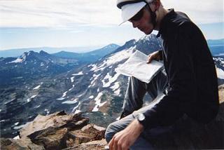
The summit of Middle Sister

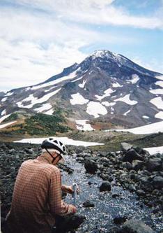
North ridge of South Sister
Copyright © 2024 Gabriel Deal.