Trips
Favorite photos
Peak lists
References
Search
Kitling Peak loop
Date:
2016/07/30 to 2016/07/31
Car-to-car:
2 days
Round-trip distance:
12 miles
Elevation gain:
4,800 feet
Trip type:
scramble
USGS quad:
Mount Arriva
Loading map...
Day 1
On Easy Pass Trail with Easy Pass in sight.
Fisher Peak from the slopes above Easy Pass.
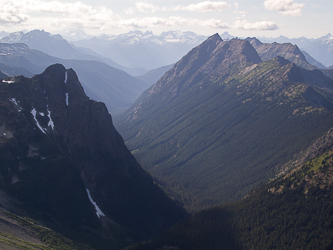
Greybeard Peak and Black Peak over the Fisher Creek valley.
Greybeard Peak from the top of Honeymoon Hump.
Mount Arriva?
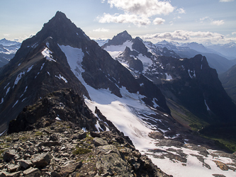
Mesahchie Peak from the west ridge of Kitling Pk.
Kitling Peak
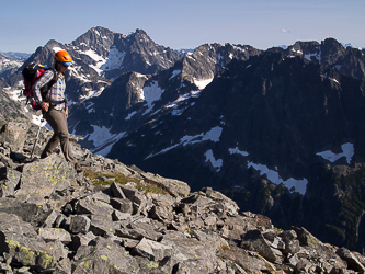
Near the summit of Kitling Pk with Black Pk, Fisher, and Arriva in the background.
Mesahchie Peak and Kimtah Peak from the summit of Kitling Pk.
Pachyderm Peak and Gabriel Peak from the summit of Kitling Pk.
Honeymoon Hump and Greybeard Peak from Kitling Pk's west ridge.
Our descent route from the Kitling/Cub col to the Mesahchie Glacier.
Mesahchie Glacier.
Mesahchie Glacier with Jack Mountain in the distance.
Mesahchie Peak over the Mesahchie Glacier.
Pachyderm Peak and Gabriel Peak
The crux of the trip. Scarified dirt around 6,600' above the outlet creek. We should have traversed the glacier further to the NE before descending.
Kimtah Peak
Mesahchie Peak from the high meadows at the head of the Panther Creek drainage.
At the Panther/Kitling pass with Mesahchie Peak in the background.
The view from our dinner table
Day 2
Mesahchie Peak, Katsuk Peak, and Kimtah Peak.
Kimtah Peak
Kitling Creek headwaters.
Granite Creek
Granite Creek
One mile of Highway 2 back to the trail head
Copyright © 2024 Gabriel Deal.
‹
›
×