Trips
Favorite photos
Peak lists
References
Contact
Search
Beaver and Anthracite Peaks
Date:
2013/12/29
Car-to-car:
6 hours 11 minutes
Trip type:
scramble
USGS quad:
Silverton
In:
Mountain Loop Highway area
References:
Matt's trip report
Loading map...
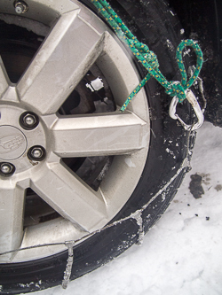
It took a lot of effort to drive the last 100 feet to the Coal Lake trail head.
We had to extend the chains with a biner and a hero loop.
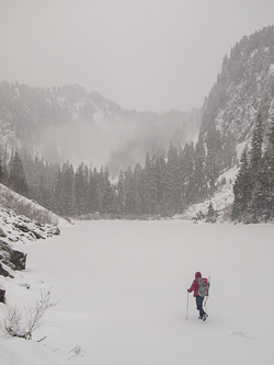
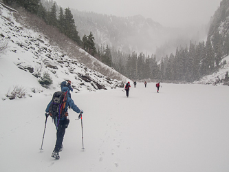
Walking across Coal Lake.
Franklin on the summit of Anthracite
Taking a lunch break before we head over to Beaver.
Looking back at Anthracite Peak.
On the east side of Beaver's north ridge.
On the summit of Beaver Peak.
Looking west down the Stillaguamish Valley. Long Mountain on the right.
Hall Peak and Marble Peak.
Big Four Mountain and Sperry Peak.
The snowshoe parking lot.
Matt took a dip!
Back on Coal Lake.
Copyright © 2024 Gabriel Deal.
‹
›
×