Fuller Mountain
This was my first trip as a Mountaineers hike leader. Interestingly
all seven of the others on the trip were also hike or scramble leaders!
From the parking area at the big four-way intersection on the North
Fork Road, go west, cross gate 10 (which may or may not be open) and
the trail starts there at the T in the road.
The major difficulty in following the Fuller Mountain trail is finding
the trail when you reach the gravel pit at the base of the mountain.
At this point you turn left for a couple hundred feet until you get to
a fork in the road. At the fork you turn sharply right, follow the
road uphill, and watch for the trail on your left.
At the summit we enjoyed the sunshine and the views to the east of
Hancock's Comb, Bessemer Mountain, Moolock Mountain, Green Mountain,
Mount Teneriffe, Dixie Peak, the Moon Wall, and the huge gravel pit
that has been carved out of the valley floor.
On the way back we turned right after the stream crossing and followed
the mostly overgrown trail that eventually loops around and rejoins
the main trail near where the trail meets the road.
In:
North Fork Snoqualmie Drainage
Car-to-car:
2 hours 35 minutes
-
1 hour 1 minute
ascending
from
North Fork gate 11 intersection
to
summit of Fuller Mountain
-
1 hour 2 minutes
descending
from
summit of Fuller Mountain
to
North Fork gate 11 intersection
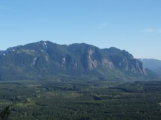
Dixie Peak and the Moon Wall from Fuller Mountain
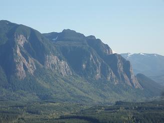
The Moon Wall from Fuller Mountain
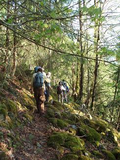
Fuller Mountain trail
Copyright © 2024 Gabriel Deal.