Evergreen Mountain via SW ridge
The Mountaineers group parked on Road 5630 (along Rapid River) at a
gravel pit shortly before an abandoned logging road starts up the
south side of Evergreen Mountain's S/SW ridge. The abandoned logging
road is shown on USGS but not Green Trails. I found the old,
regrowing logging road quite pleasant, it had lots of greenery and a
population of grouse (?) calling from the brush. The road eventually
becomes a trail then follows the nose of the ridge all the way to the
summit.
The only difficulties we encountered were centered around me,
specifically my right foot, which ended up on the wrong side of a
whoomphing crack running from a cornice at around 5,300' on the ridge.
When I cracked the cornice I was dumbly following in the snowshoe
tracks of the three people ahead of me. It made a heart-stopping
whoomph sound but luckily it only cracked an inch or two then stopped
moving. (Note: we weren't on the cornice, but we were too close
since cornices can crack diagonally upslope, as Bruce Tremper says,
"Cornices have a nasty habit of breaking farther back than you
expect.") Mary, who looked back at the sound, later told me that I
triggered an avalanche below.
At the start of the day when I turned on my avalanche beacon at the
trailhead, I asked the other party member with a beacon if his was on.
He said no, he'd turn it on if he felt like it would be useful. He
was one of the three people ahead of me who also walked on the spot
where the cornice cracked. I asked him later and found that he never
got around to turning his beacon on.
Round-trip distance:
10 miles
Elevation gain:
4,007 feet
USGS quad:
Evergreen Mountain
Car-to-car:
8 hours 21 minutes
-
18 minutes
driving there
from
Lower Queene Anne
to
70th and I-405 Park and Ride
-
33 minutes
driving there
from
70th and I-405 Park and Ride
to
Sultan Park and Ride
-
44 minutes
driving there
from
Sultan Park and Ride
to
trailhead
-
4 hours 41 minutes
ascending
from
trailhead
to
summit of Evergreen Mountain
-
3 hours 5 minutes
descending
from
summit of Evergreen Mountain
to
trailhead
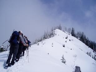
Evergreen Mountain's S/SW ridge at around 4,500'
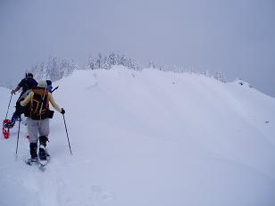
Summit of Evergreen Mountain (the lookout is on far right)
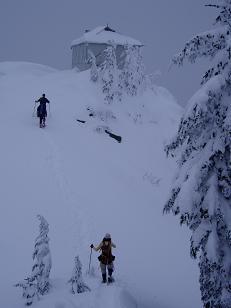
Lookout on summit of Evergreen Mountain
Copyright © 2024 Gabriel Deal.